Dataset SO267-1.201812.A
Date of Receipt
Data Type
Data Amount
Surveyed Kilometres
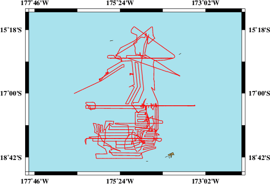
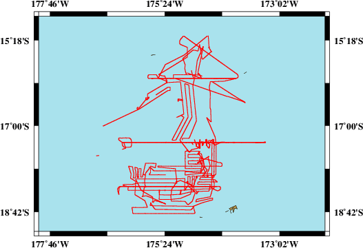
Sea Area
Data Format
Data Processing
Sound Velocity Correction
| Fahrtleiter Chief Scientist |
Prof. Dr. Mark D. Hannington | ||||||
| Vermessungszeitraum Survey Period |
2018/12/11 - 2019/01/26 | ||||||
| Auslaufhafen Port of Departure |
Suva / Fiji | ||||||
| Einlaufhafen Port of Arrival |
Suva / Fiji | ||||||
| Institution | GEOMAR | ||||||
| Positionierungssystem Positioning System |
|
||||||
| Horizontales Datum Horizontal Datum |
WGS 84 | ||||||
| Tiefenbestimmungssystem Bathymetric System |
SIMRAD EM122, ATLAS PARASOUND | ||||||
| Vertikales Datum Vertical Datum |
Sea Level. | ||||||
| Datendistribution Dataset Distribution |
|
||||||
| Zitat Citation |
Bathymetriedaten der Reise SO267/1 des Forschungsschiffes Sonne. Herausgeber: GEOMAR | Helmholtz-Zentrum für Ozeanforschung, Kiel 2018 |
||||||
| DOD-Referenz DOD-Reference |
20190001 |
| Datensatz SO267-1.201812.A Dataset SO267-1.201812.A |
Eingangsdatum: 2019/02/13 Date of Receipt |
||
|---|---|---|---|
| Datenart Data Type |
Datenmenge Data Amount |
Lotungskilometer Surveyed Kilometres |
Seegebiet Sea Area |
| Multibeam Data, Binary | 51767 MByte | 9300 | |
| Datenformat Data Format |
Datenprozessierung Data Processing |
Schallgeschwindigkeitskorrektur Sound Velocity Correction |
|
| SIMRAD EM122 (ALL & WCD) | Postprocessing software MB-System, position and depth processing. | A function sound velocity profile is used during the survey, check is used permanently during the survey. | |
| Datensatz SO267-1.201812.B Dataset SO267-1.201812.B |
Eingangsdatum: 2019/02/13 Date of Receipt |
||
|---|---|---|---|
| Datenart Data Type |
Datenmenge Data Amount |
Lotungskilometer Surveyed Kilometres |
Seegebiet Sea Area |
| Sediment Acoustic Data, Binary | 105787 MByte (ASD.ACF-PHF) 187261 MByte (ASD.ACF-SLF) 63689 MByte (PS3-PHF) 14095 MByte (PS3-SLF) |
- |  |
| Datenformat Data Format |
Datenprozessierung Data Processing |
Schallgeschwindigkeitskorrektur Sound Velocity Correction |
|
| ATLAS PARASOUND (ASD.ACF & PS3) | No information. | No information. | |