Dataset SO259-3.201712.A
Date of Receipt
Data Type
Data Amount
Surveyed Kilometres
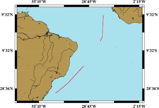
Sea Area

Data Format
Data Processing
Sound Velocity Correction
|
Fahrtleiter Chief Scientist |
Dr. Stefan Kinne | ||||||
|
Vermessungszeitraum Survey Period |
2017/10/13 - 2017/11/04 | ||||||
|
Auslaufhafen Port of Departure |
Emden / Germany | ||||||
|
Einlaufhafen Port of Arrival |
Buenos Aires / Argentina | ||||||
| Institution | Universität Hamburg, Max-Planck-Institut für Meteorologie | ||||||
|
Positionierungssystem Positioning System |
|
||||||
|
Horizontales Datum Horizontal Datum |
WGS 84 | ||||||
|
Tiefenbestimmungssystem Bathymetric System |
SIMRAD EM122, SIMRAD EM710, SIMRAD EK60, ATLAS PARASOUND | ||||||
|
Vertikales Datum Vertical Datum |
Sea Level. | ||||||
|
Datendistribution Dataset Distribution |
|
||||||
|
Zitat Citation |
Bathymetriedaten der Reise SO259/3 des Forschungsschiffes Sonne. Herausgeber: Max-Planck-Institut für Meteorologie an der Universität Hamburg, Hamburg 2017 |
||||||
|
DOD-Referenz DOD-Reference |
20180220 |
|
Datensatz SO259-3.201712.A Dataset SO259-3.201712.A |
Eingangsdatum: 2018/02/14 Date of Receipt |
||
|---|---|---|---|
|
Datenart Data Type |
Datenmenge Data Amount |
Lotungskilometer Surveyed Kilometres |
Seegebiet Sea Area |
| Multibeam Data, Binary | 36986 MByte | 6900 |
|
|
Datenformat Data Format |
Datenprozessierung Data Processing |
Schallgeschwindigkeitskorrektur Sound Velocity Correction |
|
| SIMRAD EM122 (ALL & WCD) | Postprocessing software CARIS/HIPS, position- and depth processing. | A function sound velocity profile is used during the survey. Check is used permanently during the survey. | |
|
Datensatz SO259-3.201712.B Dataset SO259-3.201712.B |
Eingangsdatum: 2018/02/14 Date of Receipt |
||
|---|---|---|---|
|
Datenart Data Type |
Datenmenge Data Amount |
Lotungskilometer Surveyed Kilometres |
Seegebiet Sea Area |
| Multibeam Data, Binary | 4716 MByte | 50 |

|
|
Datenformat Data Format |
Datenprozessierung Data Processing |
Schallgeschwindigkeitskorrektur Sound Velocity Correction |
|
| SIMRAD EM710 (ALL & WCD) | Postprocessing software CARIS/HIPS, position- and depth processing. | A function sound velocity profile is used during the survey. Check is used permanently during the survey. | |
|
Datensatz SO259-3.201712.C Dataset SO259-3.201712.C |
Eingangsdatum: 2018/02/14 Date of Receipt |
||
|---|---|---|---|
|
Datenart Data Type |
Datenmenge Data Amount |
Lotungskilometer Surveyed Kilometres |
Seegebiet Sea Area |
| Multibeam Data, Binary | 47508 MByte | 5000 |

|
|
Datenformat Data Format |
Datenprozessierung Data Processing |
Schallgeschwindigkeitskorrektur Sound Velocity Correction |
|
| SIMRAD EK60 (RAW) | No information. | No information. | |
|
Datensatz SO259-3.201712.D Dataset SO259-3.201712.D |
Eingangsdatum: 2018/02/14 Date of Receipt |
||
|---|---|---|---|
|
Datenart Data Type |
Datenmenge Data Amount |
Lotungskilometer Surveyed Kilometres |
Seegebiet Sea Area |
| Multibeam Data, Binary | 134548 MByte | 3700 |
|
|
Datenformat Data Format |
Datenprozessierung Data Processing |
Schallgeschwindigkeitskorrektur Sound Velocity Correction |
|
| SIMRAD EK60 (HAC) | No information. | No information. | |
|
Datensatz SO259-3.201712.E Dataset SO259-3.201712.E |
Eingangsdatum: 2018/02/14 Date of Receipt |
||
|---|---|---|---|
|
Datenart Data Type |
Datenmenge Data Amount |
Lotungskilometer Surveyed Kilometres |
Seegebiet Sea Area |
| Sediment Acoustic Data, Binary |
9182 MByte (ASD.ACF-PHF) 9182 MByte (ASD.ACF-SLF) 962 MByte (PS3-SLF) 1901 MByte (SEGY-SLF) |
- |
|
|
Datenformat Data Format |
Datenprozessierung Data Processing |
Schallgeschwindigkeitskorrektur Sound Velocity Correction |
|
| ATLAS PARASOUND (ASD.ACF & PS3 & SEGY) | No information. | No information. | |