| Plattform Platform |
Reise-Nr. Cruise-No. |
Zeitraum Period |
Projekt Project |
Arbeitsgebiet Working area |
|---|---|---|---|---|
| Poseidon | POS538 | 07.10.2019 - 28.10.2019 | Aegean Sea |
| Fahrtleiter Chief Scientist | Institut Institute | Auslaufhafen Port of departure | Einlaufhafen Port of return | Stationskarte Station map | Schiffsroute Trackchart |
|---|---|---|---|---|---|
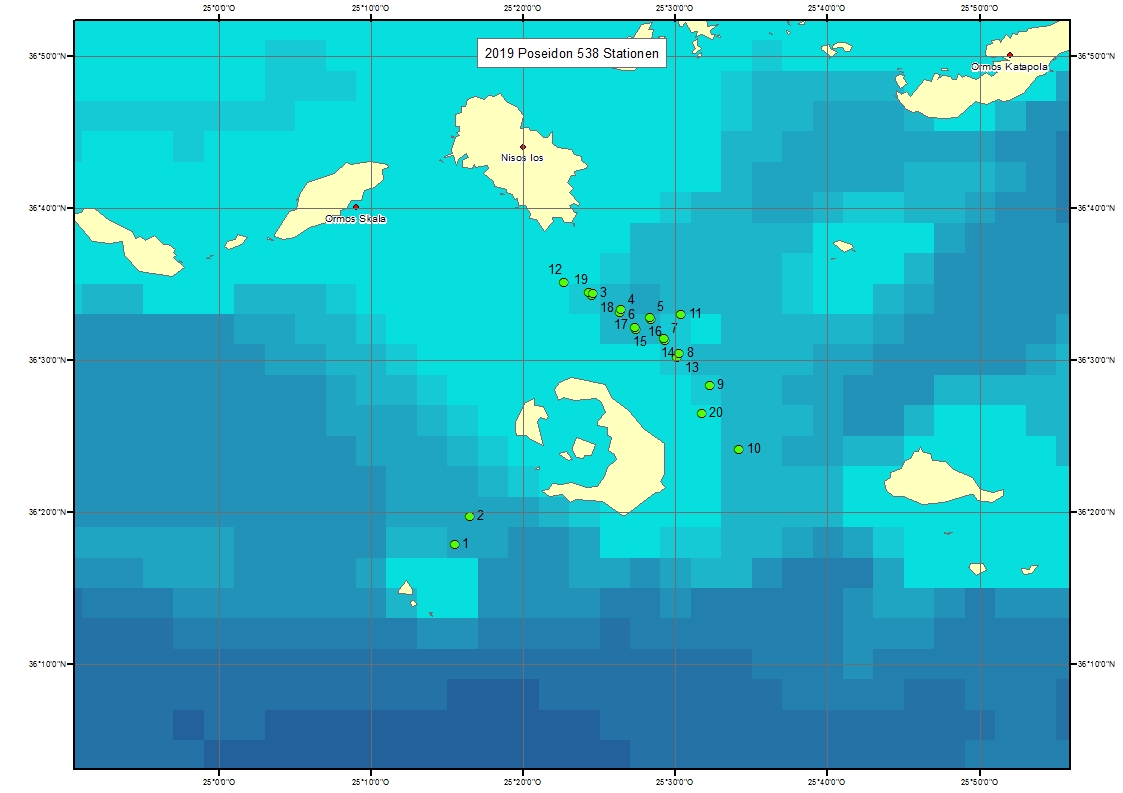
| Karstens Jens | Helmholtz Centre for Ocean Research Kiel (GEOMAR) | Cartagena | Heraklion | Karte Map |
Ziel der Reise / Objectives of Cruise:
Motivation and objectives: The main goal of the cruise was to gain a better understanding of the geological processes controlling tsunami genesis during submarine volcanogenic eruptions. The 1650 Kolumbo eruption is an excellent target, because it is possible to determine the most important parameters of different tsunami source mechanisms. These include the volumes of pyroclastic density currents and potential secondary slides as well as the number and depth of crater-forming eruptions. Furthermore, it is possible to constrain the entire growth and destruction cycle of a submarine volcanic cone and to compare this with historic eyewitness accounts. The shallow seismicity beneath the Kolumbo volcano highlights the importance of gaining a better understanding of one of Europe's most hazardous submarine volcanoes. The expected results of our experiments have not only relevance for geohazard assessment in the Aegean Sea, but will provide valuable information for the understanding of past tsunamigenic eruptions at other volcanoes like Krakatau. The cruise had three objectives: 1) The first aim of the cruise was to determine if the youngest stratigraphic subunit of the volcanic cone has been formed during a single eruption in 1650. 2) The second aim of the cruise was to test the plausibility of different tsunami source mechanisms for the 1650 Kolumbo eruption. 3) The third aim of this cruise was to acquire site survey data for the IODP proposal "Volcanic, tectonic and hydrothermal processes in an island-arc caldera environment (932-FULL)". Narrative: The cruise started on Monday, 7th of October at 8:30 from Cartagena and R/V Poseidon headed towards the research area in the eastern Mediterranean. We arrived in the working area on the 13th of October at 11:00 a.m. and began our scientific with a releaser test for our ocean bottom seismometers. At 14:00, we deployed a streamer with a 200 m long active section and the airgun and began acquiring 2D seismic profiles west of Santorini, within the Santorini Caldera and between Santorini and Amargos. At 10:00 of the 14th of October, we recovered the streamer and the airgun to deploy six ocean bottom seismometers (OBS) at Kolumbo. Afterwards we started acquiring 2D seismic data using a streamer with a 50 m long active section at 18:45. At 12:15 of the 15th of October we started with deployment of the P-Cable system, which took until 16:00, when we started acquiring data. We were able to keep the P-Cable system in the water for 7 days without any technical problems except one and a half malfunctioning streamer section. From the 15th until the 20th Of October, weather and sea conditions were very favorable for seismic acquisition. Afterwards the wind picked up and increased during the 21st of October and we had stop surveying at 22:30, but could keep the seismic equipment in the water by turning the ship into the wind. In the morning of the 22nd of October, we continued our 3D seismic survey and finalized acquiring the planned 3D seismic dataset at 14:45 and recovered the airgun and the P-Cable system. On the 23rd of October, we reequipped for 2D seismic acquisition and started a new survey at 11:00. We continued acquiring 2D seismic profiles in the Christiana Basin west of Santorini and in the Amorgos Basin northeast of Santorini on the 24th and the 25th of October. The weather conditions were good for 2D seismic data during that period, but became worse during the 25th of October. On the morning of the 26th of October, we reequipped the airgun to shoot a refractions seismic profiles over the OBS, which took from 10:15 to 11:30. Afterwards we recovered all six OBS from 14:00 to 17:00. In the morning of the 27th of October, we deployed a 2D seismic streamer with a 75 m long active section at 8:30 and started acquiring seismic profiles in the Anafi Basin west of Santorini. We recovered the streamer and the airgun at 17:45 and began our transit to Heraklion, where the cruise e
Messungen / Measurements
| Institut Institute |
Wissenschaftler Scientist |
Anzahl Number |
Einheit Unit |
Typ der Messungen Type of measurements |
Kommentar Comments |
Daten im DOD Data in DOD |
|---|---|---|---|---|---|---|
| GEOMAH | Karstens Jens | 40 | km? | G76 Multichannel seismic reflection |
P-Cable 3D seismic. 22.10.2019 | no |
| GEOMAH | Karstens Jens | 650 | km | G76 Multichannel seismic reflection |
2D seismic streamer. 27.10.2019 | no |
| GEOMAH | Karstens Jens | 20 | stations | H00 Stations |
- | yes |
Verankerungen / Moorings
| Institut Institute |
Wissenschaftler Scientist |
Typ der Messungen Type of measurements |
Kommentar Comments |
geogr.Breite Latitude |
geogr.Länge Longitude |
Daten im DOD Data in DOD |
|---|---|---|---|---|---|---|
| GEOMAH | Karstens Jens | G72 | Ocean-bottom seismometer 01 | 36° 34.4' N | 25° 24.5' E | no |
| GEOMAH | Karstens Jens | G72 | Ocean-bottom seismometer 02 | 36° 33.3' N | 25° 26.4' E | no |
| GEOMAH | Karstens Jens | G72 | Ocean-bottom seismometer 03 | 36° 32.8' N | 25° 28.3' E | no |
| GEOMAH | Karstens Jens | G72 | Ocean-bottom seismometer 04 | 36° 32.2' N | 25° 27.4' E | no |
| GEOMAH | Karstens Jens | G72 | Ocean-bottom seismometer 05 | 36° 31.4' N | 25° 29.2' E | no |
| GEOMAH | Karstens Jens | G72 | Ocean-bottom seismometer 06 | 36° 30.4' N | 25° 30.2' E | no |