| Plattform Platform |
Reise-Nr. Cruise-No. |
Zeitraum Period |
Projekt Project |
Arbeitsgebiet Working area |
|---|---|---|---|---|
| Alkor | AL529 | 07.10.2019 - 10.10.2019 | Baltic Sea Western Baltic Sea |
| Fahrtleiter Chief Scientist | Institut Institute | Auslaufhafen Port of departure | Einlaufhafen Port of return | Stationskarte Station map | Schiffsroute Trackchart |
|---|---|---|---|---|---|
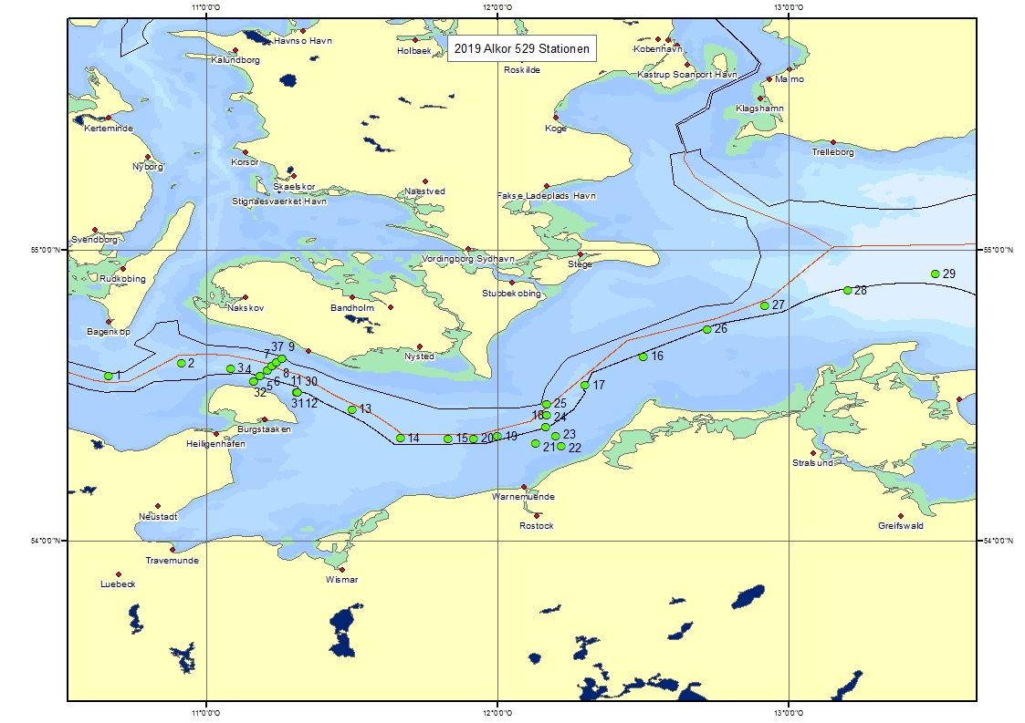
| Karstensen Johannes | Helmholtz Centre for Ocean Research Kiel (GEOMAR) | Kiel | Kiel | Karte Map |
Ziel der Reise / Objectives of Cruise:
The main purpose of the ALKOR cruise AL529 was the training of students in observational techniques applied by physical oceanographers. The students who participated in the trip attend the module "Measurement Methods of Oceanography" which is offered in the Bachelor program "Physics of the Earth System" at CAU Kiel. During the AL529 the students were instructed in instrument calibration and in the interpretation of measurement data at sea. In addition, the students had the opportunity to learn about working and living at sea and to explore and study the impact of physical processes in the western Baltic Sea, the sea at their doorstep. The observations show a quasi-synoptic picture of the hydrography and currents in the western Baltic Sea. Twice-repeated hydrographic and current sections across the Fehmarn Belt show well the short time scales where significant changes occur. A zonal section along the deepest topography, from about 010?40'E to 014?21'E, shows very nicely the two-layer system of outflowing low salinity and inflowing North Sea water. A bottom shield anchorage shows the currents in the water column and the near-bottom temperature and salinity variations in the Fehmarnbelt area.
Messungen / Measurements
| Institut Institute |
Wissenschaftler Scientist |
Anzahl Number |
Einheit Unit |
Typ der Messungen Type of measurements |
Kommentar Comments |
Daten im DOD Data in DOD |
|---|---|---|---|---|---|---|
| GEOMAH | Karstensen Johannes | 37 | stations | H00 Stations |
- | yes |
Verankerungen / Moorings
| Institut Institute |
Wissenschaftler Scientist |
Typ der Messungen Type of measurements |
Kommentar Comments |
geogr.Breite Latitude |
geogr.Länge Longitude |
Daten im DOD Data in DOD |
|---|---|---|---|---|---|---|
| GEOMAH | Karstensen Johannes | H11 | - | 54° 35.4' N | 11° 18.7' E | Ref Date 10.10.2019 |