| Plattform Platform |
Reise-Nr. Cruise-No. |
Zeitraum Period |
Projekt Project |
Arbeitsgebiet Working area |
|---|---|---|---|---|
| Sonne1 | 143-2 | 31.07.1999 - 25.08.1999 | TECFLUX |
NE Pacific (Limit 180?) |
| Fahrtleiter Chief Scientist | Institut Institute | Auslaufhafen Port of departure | Einlaufhafen Port of return | Stationskarte Station map | Schiffsroute Trackchart |
|---|---|---|---|---|---|
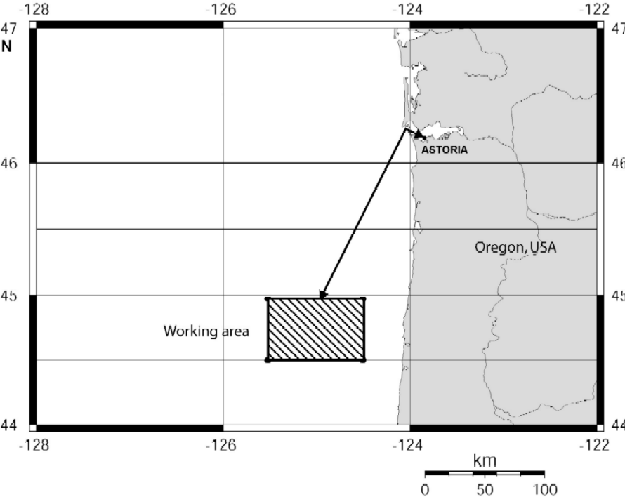
| Pfannkuche Olaf | Forschungszentrum fur Marine Geowissenschaften, Kiel | Astoria | Astoria | Karte Map |
Ziel der Reise / Objectives of Cruise:
The TECFLUX programme addressed geophysical, biogeochemical and hydrographic processes associated with fluid venting and gas hydrate outcropping at the Hydrate Ridge off Oregon, USA. SO 143-2 was one of 8 expeditions in 1999 which led to Hydrate Ridge. Scientists from Germany, Canada, Japan and the USA participated in the TECFLUX programme. Investigation at SO143-2 concentrated on:- -methane plume detections (18kHz echosounder) and methane measurements in the water column (CTD/Ro casts) -visual observation of seep communities (OFOS) - sediment sampling with box grab and multiple corer (biogeochemistry, porewater geochemistry, microbiological investigations, faunal analysis) Lander deployments to measure benthic metabolism and in situ fluid flow. SO 143-2 started and ended in Astoria Oregon. USA. Investigations were restricted to the Hydrate Ridge area.
Messungen / Measurements
| Institut Institute |
Wissenschaftler Scientist |
Anzahl Number |
Einheit Unit |
Typ der Messungen Type of measurements |
Kommentar Comments |
Daten im DOD Data in DOD |
|---|---|---|---|---|---|---|
| MPIMHB | Boetius Antje | 18 | stations | B16 Benthic bacteria / micro-organisms |
Multiple corer samples samples (sediment microbiology) | no |
| GEOMAR | Pfannkuche Olaf | 12 | stations | B72 Biochemical measurements (e.g. lipids, aminoacids) |
Multiple corer samples samples (sediment biochemistry) | no |
| GEOUNB | Sahling H. | 2 | stations | B90 Other biological / fishery measurements |
Beam trawls (megafauna) | no |
| GEOUNB | Sahling H. | 16 | stations | G02 Grab |
Grabs (sediments, gashydrates, infauna) | no |
| MPIMHB | Boetius Antje | 18 | stations | G04 Core-soft bottom (no. of cores) |
Multiple corer samples samples (sediment microbiology) | no |
| GEOMAR | Wallmann K. | 11 | stations | G04 Core-soft bottom (no. of cores) |
Multiple corer samples samples (sediment pore water geochemistry) | no |
| GEOMAR | Pfannkuche Olaf | 12 | stations | G04 Core-soft bottom (no. of cores) |
Multiple corer samples samples (sediment biochemistry) | no |
| GEOUNB | Sahling H. | 10 | stations | G08 Bottom photography |
OFOS surveys (films, B18) | no |
| GEOMAR | Linke Peter | 4 | mooring(s) | G71 In-situ sea floor measurements |
Short term lander deployments (benthic activity, fluid flow) | no |
| MPIMHB | Witte Ursula | 10 | mooring(s) | G71 In-situ sea floor measurements |
Short term lander deployments (benthic metabolism) | no |
| GEOMAR | Pfannkuche Olaf | 3 | stations | G73 Single-beam echosounding |
18KHz gas plume detection | no |
| GEOMAR | Pfannkuche Olaf | 43 | profiles | G74 Multi-beam echosounding |
Swath bathymetry, Parasound | no |
| GEOMAR | Pfannkuche Olaf | 22 | stations | H10 CTD-Stations |
CTD/Rosette sampler, water column methane measurements | no |
| GEOMAR | Pfannkuche Olaf | 22 | stations | H33 Other dissolved gases |
CTD/Rosette sampler, water column methane measurements | no |
Verankerungen / Moorings
| Institut Institute |
Wissenschaftler Scientist |
Typ der Messungen Type of measurements |
Kommentar Comments |
geogr.Breite Latitude |
geogr.Länge Longitude |
Daten im DOD Data in DOD |
|---|---|---|---|---|---|---|
| GEOMAR | Pfannkuche Olaf | G71 | Lander deployments (benthic metabolism & activity)) | 44° 35.0' N | 125° 59.0' W | - |
| GEOMAR | Linke Peter | G71 | Lander deployments ( fluid flow) | 44° 35.0' N | 125° 59.0' W | - |
| GEOMAR | Linke Peter | H09 | Lander deployments ( fluid flow) | 44° 35.0' N | 125° 59.0' W | - |